placeholder EN


Route
Santa Caterina Valfurva - Rifugio Plaghera - torrente dell'Alpe - Rifugio Bemi - Passo Gavia
Info about the route
Total lenght: 13,5 km
Start: Valfurva (1734 m)
Arrival: Gavia Pass (2618 m)
Difference in altitude: 884 m
Average gradient: 6,5 %
DESCRIPTION
The Gavia Pass is one of the highest mountain passes in Europe and links Valtellina and Ponte di Legno, in the province of Brescia.
From Santa Caterina Valfurva, the road climbs some 900 m in a little over 13 km, with an average gradient of 6.5%. Some sections are easy, while others are definitely a challenge. The Brescian side from Ponte di Legno is harder: it’s approx. 18 km long with a gradient of up to 16% and total elevation change of about 1.360 m.
Several times the Cima Coppi of the Giro d’Italia, the Gavia Pass entered cycling history on 5 June 1988 when, in heavy snow and below-zero temperatures, Dutch rider Johan Van der Velde broke away and took on the Gavia climb in a cotton shirt and almost got hypothermia.
ELEVATION PROFILE
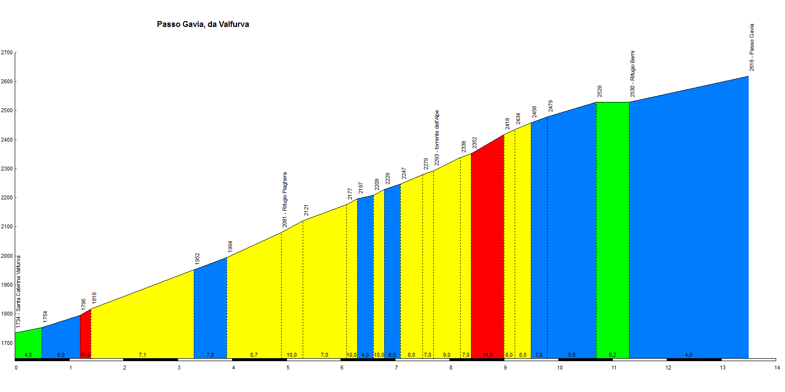
Fonte: Salite.ch


