placeholder EN


Sondrio Valmalenco
E-bike - Chiesa Valmalenco, Campo Moro
Chiesa Valmalenco, Lanzada, Tornadri, Campo Franscia, Largone, Campo Moro - ritorno a Chiesa Valmalenco
- Starting point: Chiesa Valmalenco (950)
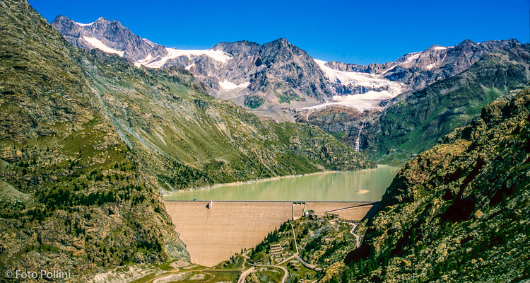
- Ending point: Campo Moro (1990)
- Max. altitude: 1990 m s.l.m.
- Ascent: 1040 m
- Descent: 1040 m
- Total climbing: 16 km
- Total descending: 16 km
- Total distance on flat: 0 km
- Lenght: 32 km
- Duration: 2 - 3 h
- Difficulty: Medium
- Average slope : 6%
- Max. slope: 11%
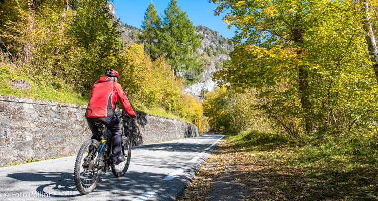
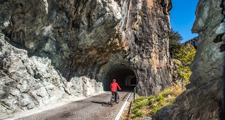
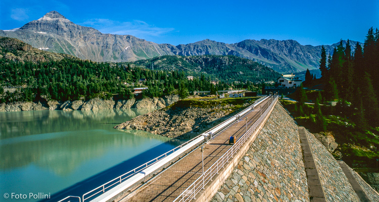
The climb is all on tarmac with feasible, constant gradients to Campo Franscia. Pedal through the characteristic tunnels dug out of the rocks, some of which are long and dark and so we recommend to use lights on your bike. The next stretch sees the gradients increase, with various hairpins and short tunnels taking you to the car parks of the two mountain refuges at Campo Moro, close to the artificial lake of the same name. In the distance you will see the other big dam, Alpe Gera, standing out, which can be reached in order to admire its high mountain views with peaks and glaciers. From Campo Moro you can pick up route no. 41 by crossing the two dams, going below the second one and back up to Campolungo along rough tracks and trails.
Testi e dati tecnici a cura di Federico Pollini