Are you dreaming to climb the Stelvio, the Gavia and the Mortirolo passes like the great champions of the Giro d'Italia?
In Valtellina you can challenge some of cycling’s most famous uphill stretches: here're the 10 toughest climbs In cycling!
1. THE STELVIO PASS
A Holy Grail for cyclists, Stelvio Pass is accessed via a spectacular series of corners (40 from Bormio, 48 from Alto Adige) linking Valtellina with the Autonomous Province of Bolzano. Just below the pass, on the Valtellina side, the road crosses the Umbrail Pass, which leads into Engadina (Switzerland).
The Valtellina side, which starts from Bormio, is approximately 21 km long, with a total elevation change of 1.533 m and an average gradient of 7.1%
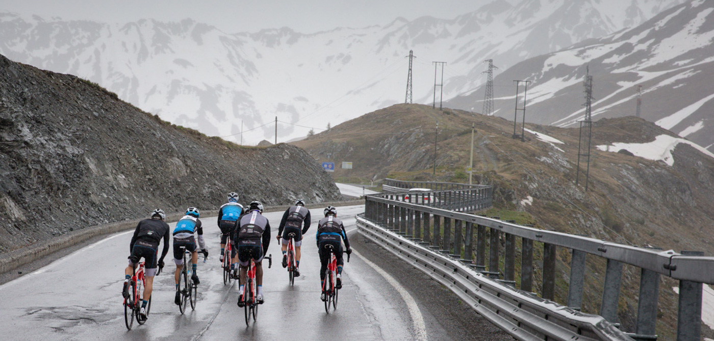
2. THE GAVIA PASS
The Gavia Pass is one of the highest mountain passes in Europe and links Valtellina and Ponte di Legno, in the province of Brescia. From Santa Caterina Valfurva, the road climbs some 900 m in a little over 13 km, with an average gradient of 6.5%. Some sections are easy, while others are definitely a challenge. The Brescian side from Ponte di Legno is harder: it’s approx. 18 km long with a gradient of up to 16% and total elevation change of about 1.360 m.
Several times the Cima Coppi of the Giro d’Italia, the Gavia Pass entered cycling history on 5 June 1988 when, in heavy snow and below-zero temperatures, Dutch rider Johan Van der Velde broke away and took on the Gavia climb in a cotton shirt and almost got hypothermia.
The Valtellina side, which starts from S. Caterina Valfurva, is approximately 13 km long, with a total elevation change of 884 m and an average gradient of 6.5%
3. the mortirolo pass
The Mortirolo Pass, which links the province of Sondrio with the province of Brescia, may “only” be 1.852 m above sea level, but it is one of the hardest, most challenging passes in the Alps. From the valley floor, you can reach Mortirolo Pass from various access routes:
from Mazzo di Valtellina: 12 km of climb with 1300 m of elevation change;
from Tiolo (in Grosio) with a climb of 14 km and 1100 m of elevation change;
from Tovo Sant'Agata with a climb of 12.5 km and more than 1300 m of elevation change
Like other passes in Valtellina, Mortirolo has repeatedly starred in the Giro d’Italia.
Check out more details here
4. the spluga pass in valchiavenna
Situated at an altitude of 2,117 m, the Spluga Pass is one of the classic road cycling climbs in Valchiavenna. The modern road follows the route of the road constructed in 1800 by the Austrians. After Chiavenna, the route gradually climbs up to the Campodolcino plain, which is followed by the famous 10 corners up to Pianazzo. A little later, you come to a fork: right takes you to the famous Madesimo tourist resort and left leads to the hairpins and tunnels of the Andossi, offering a wonderful view. You then come to the artificial lake and town of Montespluga, and the final steep hairpins up to the pass.
From Chiavenna the climb up to the Spluga Pass is 30 km with a difference in altitude of 1780 m and an average gradient of 5.9%
5. the lakes of cancano climb
Now considered a must-ride, the ribbon-like hairpins up to the Cancano lakes have become the stuff of legends. Located in the Stelvio National Park, this fairly mellow climb with a consistently rideable gradient is suitable for road, mountain bike or gravel riders. Head out of Bormio past the charming church of San Gallo. Once you’re through Premadio, go straight on at the junction. Here’s where the ascent begins and the view into Valdidentro reveals itself.
From Bormio the climb up Cancano is about 28 km with a difference in altitude of 725 meters
6. the san marco pass
At an altitude of 1.992 m, San Marco famously featured in the insignia of the former Republic of Venezia, which built the ancient Via Priula to improve trade with territories controlled by the Grisons. The old road, which was named Priula in honour of the former governor of Bergamo Alvise Priuli, can still be seen under the new asphalted road in places.
From Morbegno the climb to the San Marco Pass is 26 km long, with a total elevation change of 1723 m and an average gradient of 6.5%
7. the aprica pass
While it’s something of a regular in the Giro d’Italia, this wide road with sweeping hairpins does not tend to be a game-changer for the general classification. Roughly 12 km with an average gradient that just tips over 6%, there are signs that count down the distance as you approach the pass. The road is open to traffic and can be particularly busy on weekends, so ride carefully. On future visits when you’re feeling extra fit, try some of the road’s tougher variants and follow the turnings for Santa Cristina or San Rocco.
From Tresenda the climb up Aprica is 13 km with a total elevation change of 800 meters and an average gradient of 6%
8. BAGNI DI MASINO, a full immersion in nature
Val Masino, with its scenic landscapes (Val di Mello is the largest natural reserve in Lombardy), can be an interesting alternative to the more famous climbs of road cycling.
From Masino you can take the road that crosses the small villages of Cataeggio and San Martino before reaching the Bagni di Masino, also famous for the presence of the Bagni di Masino Forest, a paradise for fall foliage
From Masino the climb up to Bagni di Masino is about 17 km with a total elevation change of 900 meters and an average gradient of 5.2%
9. verso le DIGHE DI CAMPO MORO, IN VALMALENCO
Famous for hiking, Valmalenco also offers some interesting routes for road cycling enthusiasts.
This is the case of the climb that leads from Lanzada to the Campo Moro dam, which was in the past also the protagonist of the women's Giro d'Italia. The route, of great scenic beauty, is about 15 km long and is also characterized by the presence of numerous short tunnels dug into the rock.
From Lanzada the climb up Campo Moro is about 15 km with a total elevation change of 1000 meters and an average gradient of 6%
10. foscagno pass
The only access road from Italy to Livigno, the Foscagno Pass reaches 2291 m and connects Livigno with Valdidentro. Once you have passed the customs (Livigno is a "duty-free zone") you will initially face a descent of about 5 km which then leads again to a climb towards the village of Trepalle, at 2069 m (the highest parish in Europe ) and again a final descent towards Livigno.
From Isolaccia (Valdidentro) the climb up the Foscagno Pass is about 15.5 km with a total elevation change of 946 meters and an average gradient of 6.1%
- Last meters before reaching the Foscagno Pass
and many other climbs between italy and switzerland, in the heart of the alps
La Valtellina, al confine con la Svizzera, presenta poi altre grandi salite che portano nel paese elvetico e dove "sfidare" le proprie capacità: il Passo del Bernina (da Tirano all'Engadina toccando i 2328 m), il Maloja (da Chiavenna a St. Moritz) e la Forcola (da Livigno verso la Val Poschiavo).
Valtellina, on the border with Switzerland, offer many other climbs such as the Bernina Pass (from Tirano to the Engadin), the Maloja Pass (from Chiavenna to St. Moritz) and the Forcola Pass (from Livigno towards Val Poschiavo)
CHECK OUT EVENTS AND ROUTES FOR ROAD CYCLING IN VALTELLINA


